
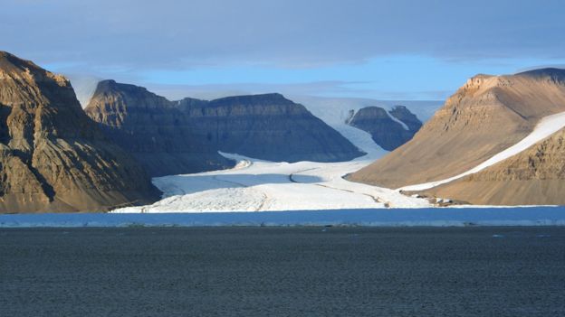
Scientists have produced a stunning visualisation of Greenland – without its ice cover.
It is made from decades of survey data that show the position and shape of the territory’s bedrock, and the surrounding seafloor.
This is critical information needed to understand how the huge island might respond to a warming world.
Were all the ice on Greenland to melt, it would raise global sea-levels by 7.42m (24.34ft).
This is one of the refined statistics to come out of the new compilation of data. It is a simple calculation: if you know the elevation of the top of the ice sheet and you subtract from that the height of the bedrock – you get a volume: 2.9 million cubic km.
“It gives us seven cm more of sea-level potential – a little bit more than we thought, but not a whole lot more,” explained Dr Mathieu Morlighem from the University of California at Irvine, US.
“And the reason for that is that although we do find deeper fjords and deeper valleys, they’re very narrow and constrained along the sides of the ice sheet. The interior hasn’t change a lot, however.”
Total ice area: 1.799 million sq km
Total ice volume: 2.99 million cu km
Mean thickness: 1,673m
Thickest ice: 3,488m
For comparison, the Antarctic ice sheet has a volume of 26.5 million cu km
Presentational grey line
Greenland is currently losing about 260 billion tonnes of ice to the ocean every year. It sounds a lot – and it is, but no-one is expecting an immediate collapse – not for centuries, at least.
Nonetheless, some of the answers as to how fast changes may come will be in this map’s data.
“If you’re trying to model an ice sheet, the single most important input is ice thickness,” said Prof Jonathan Bamber. “Why’s that? Because velocity is proportional to the fourth power of thickness. So differences in thickness make for huge differences in the velocity of the ice in our models; and to things like thermodynamics, because thick ice is warmer than thin ice, and so on,” the Bristol University, UK, glaciologist told BBC News.
The colourful map is being distributed here at the Fall Meeting of the American Geophysical Union (AGU), the largest annual gathering of Earth and planetary scientists.